The Latest
-
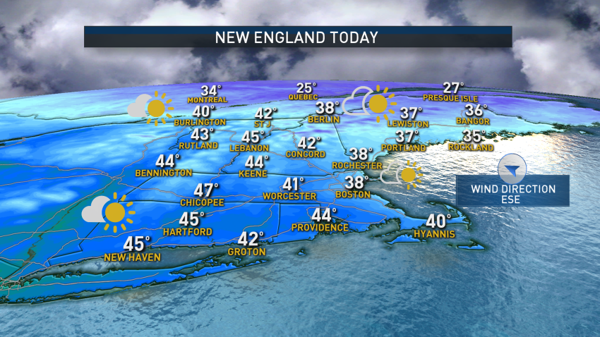
The Cold is Back, But Temperatures Will Rise on Friday
An area of high pressure shifting over New England will result in cool temperatures and dry weather on Monday. Expecting high temperatures to rise into the upper 30s to mid-40s across most of the region today. Clouds will be on the increase from southwest to northeast ahead of a developing area of low pressure in the Mid-Atlantic. Thanks to...
-
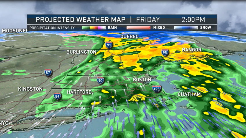
Steady Rain Showers Expected Friday Afternoon Ahead of Sunny Saturday
Today: Windswept showers until evening, then clearing. Highs near 60.
Overnight Friday: Mostly clear, breezy. Lows in the 30s.
Saturday: Sunny, breezy. Highs in the 50s.
Sunday: Cool, bright. Highs in the 40s. -
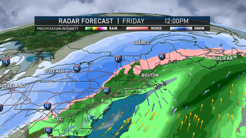
Heavy Rain, Snow Across Region; Hurricane-Force Gusts Possible Later
An area of low pressure will track out of the Mid-Atlantic region today. The system will pass through southern New England, strengthening rapidly as it nears the Gulf of Maine. Expect freezing rain for much of New Hampshire and Maine with heavy snow developing in northern areas, heavy rain across southern New England. These icy conditions will result in tricky…
-
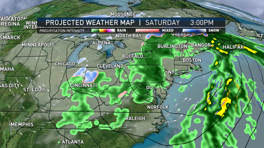
Widespread Rain to End Our Week, Begin Weekend
It will be unseasonably cold and dry Thursday as a sprawling area of high pressure originating from the Great Lakes settles over New England. High temperatures only top out in the upper 20s to low 30s Thursday, despite being under mostly sunny skies. Dry weather persists overnight along with unseasonably cold temperatures. Lows will fall into the mid-teens to...
-
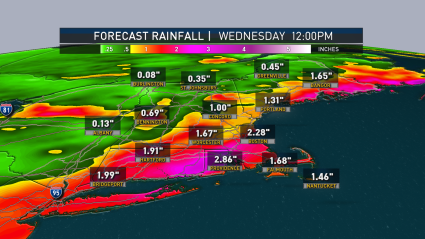
FIRST ALERT: Steady Rain, Increasing Wind Throughout the Day
Milder air filters in across New England Monday as a developing area of low pressure approaches the region from the Great Lakes. Showers develop to steady rain with winds increasing during the late day and evening, eventually gusting up to 45 mph and up to 50 mph across the Cape and Islands, as well as Coastal Maine and the Penobscot…
-

Flash Freeze Sets In Amid Winter Storm in New England
A flash freeze is now occurring across interior Southern New England in places such as Reading, Boston and Brockton as arctic air spills south along a coastal front that has set up across Eastern New England. A sleet storm continues across Central and Northern Massachusetts. We’re also saw impacts at the coast ahead of the 10:00 a.m. high tide cycle,...
-

Flash Freeze Sets in as Winter Storm Hits New England
Several inches of snow have fallen across New England overnight, with most areas across southern New England having received 2 to 5 inches, with areas across central and northern New England receiving 8-plus inches. By dawn, warmer air will already be working up from the south, changing snow to a wintry mix of sleet and freezing rain along the South...
-

Calm Start Before Stormy Tuesday Afternoon
Showers and thunderstorms pop up across New England today as an upper-level disturbance and cold front pass overhead. Cold air aloft, combined with strong day-time heating will result in some thunderstorms becoming strong.
-

Storms Expected Tuesday Afternoon
Disturbance slides across the area, ushering in more potent thunderstorms as well as more widespread thunderstorms by the afternoon and extending into the evening
-

Heat Wave Continues With Hot and Hazy Monday
Monday is day two of our heat wave with high temperatures in the middle 90s. This will likely be the warmest day of the stretch.

