The Latest
-

Quadrantid meteor shower to be visible all weekend over New England
The wind remains persistent through this weekend. However, each day it decreases a bit. Wind damage and outages were found across New England from Thursday’s winds of 50-60 mph in some spots. In fact, Boston saw a 58 mph gust on Thursday. On Friday, we expect winds to peak around 40 mph from the west/northwest. That means our wind chills will be in the...
-

New Year's Eve stays mostly dry, with raindrops falling as the ball drops
The dry weather continues through much of this New Year’s Eve…until midnight. High temps top off in the low 50s again with a mix of clouds and sun. As you head to First Night festivities in Boston, our next low pressure system heads in from the Midwest. The showers begin right around midnight and will last through daybreak on New...
-

First Night forecast calls for rain; another chance for snow next week
Our Monday started off rather soggy as a cold front moved through. This brought 0.5 inches to 1 inch of rainfall through much of New England. We continue to dry off Monday afternoon with some lingering showers or sprinkles through sunset. With a breeze from the southwest, the roads dry off fast, but the lawns may stay muddy as you get the...
-

FIRST ALERT: Snow totals for Friday-Saturday storm upgraded, 3-6 inches for some
3:30 p.m. update from Chief Meteorologist Pete Bouchard: Snow continues through the evening, gradually wrapping up between 9-11 p.m. The snow intensity will vary through the afternoon drive, with some spots seeing up to 1 inch per hour. Roads are slippery and traffic is pretty nasty with the approaching holiday. Cold air rushed in earlier than anticipated with this event....
-

Showers and flurries this week, but will we have snow on Christmas?
We had a little taste of true winter in southwestern New England on Monday morning as a quick moving system passed south of us. Temperatures were cold enough to support 1-2 inches of snow in parts of western Massachusetts and Connecticut and a coating of snow in northern Rhode Island. Even though it was cold enough for some snow, it wasn’t...
-

How much snow will we see in New England this winter?
We have an odd relationship with winter forecasts. On one hand, we know that it’s impossible to pin down three months of howling winds, snowstorms, freakish warmups, bitter blasts and an early/late arrival to spring, but we still want something — anything — that could give us a hint at what’s to come. Perhaps it gives us something to think...
-

TIMELINE, IMPACTS: When and where we could see snow Thanksgiving week
Our pattern has flipped and we now have a “cornucopia” of unsettled weather and precipitation types in our Thanksgiving outlook. A strong low pressure system continues to meander across New England on Friday and through the weekend. By late Saturday into Sunday, the low is over the Canadian Maritimes but will still affect our weather pattern. On Friday, our scattered rain...
-

Warmer temps, fire danger, coastal flooding. Here's a look at the weekend forecast
The dry weather marches on in our 10-day forecast as any chances for rain continued to get squashed by our ongoing drought and overall weather pattern. This weekend is another beautiful one for any outdoor plans or activities. Starting Friday, we see warming temperatures, after morning lows dipped to the 20s or 30s. Sunshine continues to spill across the northeast, with...
-

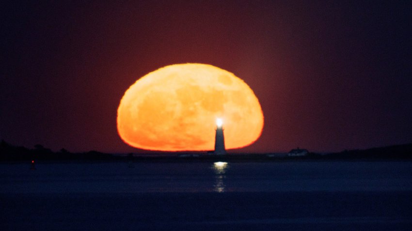
The last supermoon of 2024 is rising in New England!
Here’s how to see the last supermoon of 2024, and what cloud cover will be like in Massachusetts and New Hampshire for the Beaver or Snow Moon’s rise.
-

Wintry chill arrives, temps in the teens and 20s overnight
A wintry chill has arrived on this Wednesday. For the first time in a long time, our temperatures remain below normal for lows and highs. Boston, for reference, averages a high of 52 and a low of 39 for this date. Highs on Wednesday only top off in the 40s after morning lows dropped to the low 30s. In fact, Boston Logan International...

