The Latest
-

Wintry chill arrives, temps in the teens and 20s overnight
A wintry chill has arrived on this Wednesday. For the first time in a long time, our temperatures remain below normal for lows and highs. Boston, for reference, averages a high of 52 and a low of 39 for this date. Highs on Wednesday only top off in the 40s after morning lows dropped to the low 30s. In fact, Boston Logan International...
-
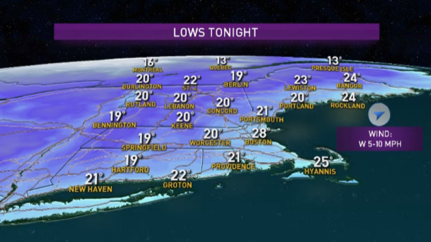
Icy Road Conditions Sunday Morning As Temperatures Continue to Fall
Temperatures continue to fall as the sky clears this evening. Overnight lows drop to the teens across the North Country and to the 20s everywhere else. This means it will be icy again through morning along New England roads. Our river flooding continues to improve in most river locations after a minor flood stage was reported this afternoon along the...
-
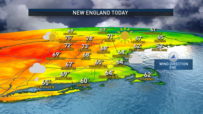
Cool Temperatures This Holiday Weekend
This is due to a wind direction flip which is now from the east northeast as an area of low pressure passes south of us.Scattered showers and some rumbles of thunder will continue this morning into this afternoon across Massachusetts, Connecticut, and Rhode Island.
-
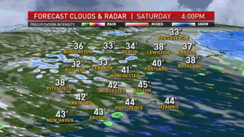
Mostly Dry Mother's Day to Follow Cold, Windy Saturday
We picked up a few inches of snow in northern New England! The snow showers linger across eastern Maine through this evening. Other snow showers will develop due to upslope snowfall and squalls in the mountains. Southern New England can expect sunshine, but pop up showers and clouds develop in the afternoon. Some of the clouds may produce graupel, or...
-
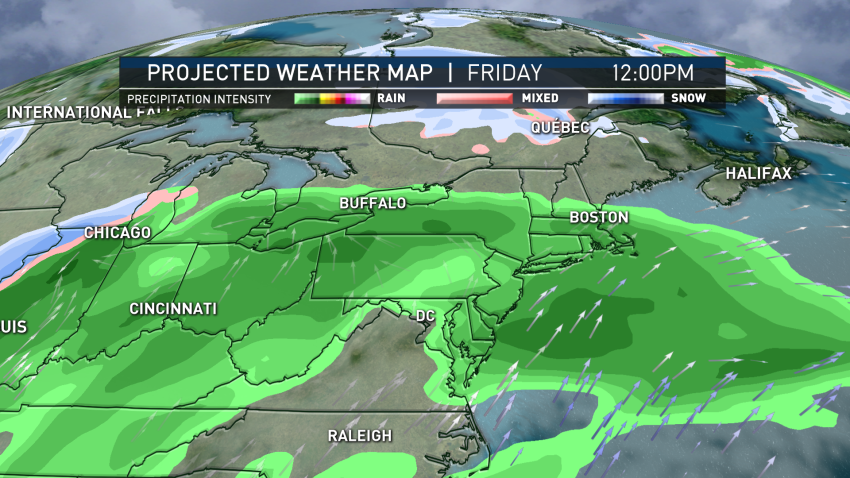
Clear Weather Welcomes 2020
Average highs should be in the upper 30s while average lows are in the low 20s across New England and our temperatures were pretty close this afternoon. Although with a gusty west wind, it did feel cooler. The breeze sticks around for tonight into Thursday, but won’t be as strong as today. This evening will be mainly dry, with...
-
Wintry Mix Continues Into Tuesday
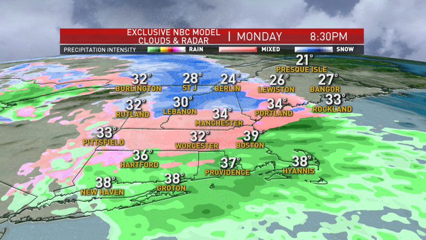
A layer of cold air is found across western and central New England this evening, just like it has been around all day. This means along and north of the Massachusetts Turnpike we will continue to see icing and sleet, while along the Pike and south we can get a little mixing, but it will be mostly rain. The freezing…
-
Wintry Mix to Impact Parts of New England for End of Year
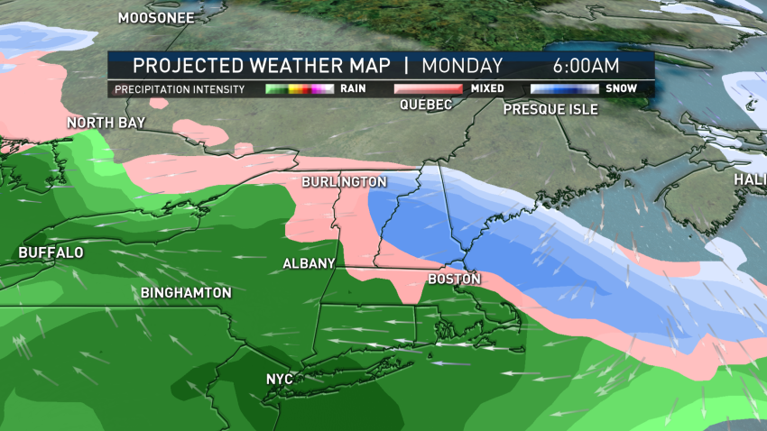
We had a wintry mix across northern New England and icing across Maine, but this precipitation wraps up tonight. Southern New England saw a cloudy day with spotty sprinkles and mild temperatures with a gusty southwest wind. As we head into the weekend, the weather will cooperate for any holiday gift returns or travel. A breeze will stick around through…
-
Freezing Rain Prompts Icing Threat in Northern New England, Gusty Winds South
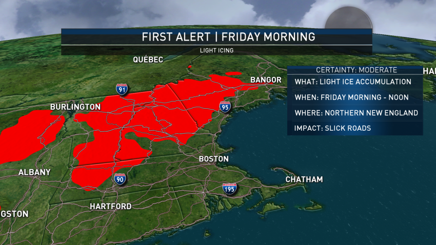
A frontal boundary has stalled right across the region and this sets us up for a period of freezing rain and a wintry mix in northern New England Friday morning through early afternoon. We have a First Alert for those areas due to the slick spots expected on the roads across northern Vermont, New Hampshire and Maine. The warm...
-
Temps to Briefly Cool Down Before Another Warm-Up in New England
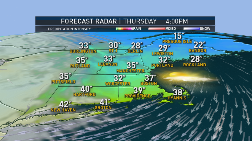
Our post-Christmas forecast will be very similar to the actual holiday with highs Thursday in the upper 30s to lower 40s. In the morning, there may be some patchy black ice again and spots of fog, but our thaw continues Thursday afternoon even with cooler air in place. The cloud cover will also decrease a bit by afternoon. Warmer...
-
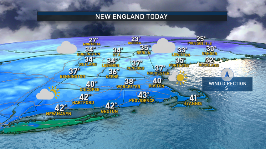
Chilly, Quiet Christmas Morning
Temperatures fell to the 20s overnight, and the wind has diminished. There are some slick spots early Wednesday morning due to some refreezing. We are waking up to chilly, but dry conditions. There will be no white Christmas this year in Boston since all the snow melted away earlier this week. Our weather pattern continues to be calm and...

