


Here’s a look at this weekend’s forecast for New England and the latest on Helene’s remnants.
Follow NBC10 Boston:
https://instagram.com/nbc10boston
https://tiktok.com/@nbc10boston
https://facebook.com/NBC10Boston
https://twitter.com/NBC10Boston
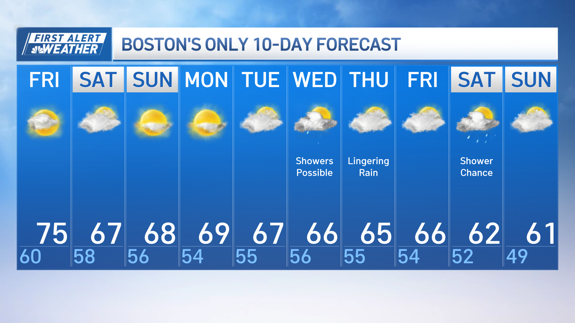
What a difference a day makes! After a gloomy, rainy Thursday, we’re looking ahead to some sunshine today and warmer temperatures.
So, as we move through this Friday, highs will reach the mid 70s. Yes, the mid 70s! In fact, our forecast high will be a few degrees warmer than our average high temperature of 69 degrees. Enjoy! We’ll see a mix of sun and clouds. Then Friday night, we’ll see partly cloudy skies and low temperatures in the upper 50s.


Saturday will be a bit unsettled in Greater Boston. We’ll see a little filtered sunshine between the clouds. Most of the day in Boston will be dry, but a few sprinkles are possible in western and central Massachusetts. High temperatures will be in the mid to upper 60s.

We’ll see partly cloudy skies on Sunday with highs in the upper 60s.

A little more sunshine is expected Monday before the clouds roll back in on Tuesday ahead of a few scattered showers. We’ll keep you posted.
High temperatures will be near 70 on Monday, then back into the 60s Tuesday and Wednesday.
We’re also keeping an eye on Helene. The storm made landfall Thursday night over Florida, bringing catastrophic conditions to parts of the South. The storm will continue to move inland, spreading flooding rain, gusty winds and the threat for tornadoes to that region.
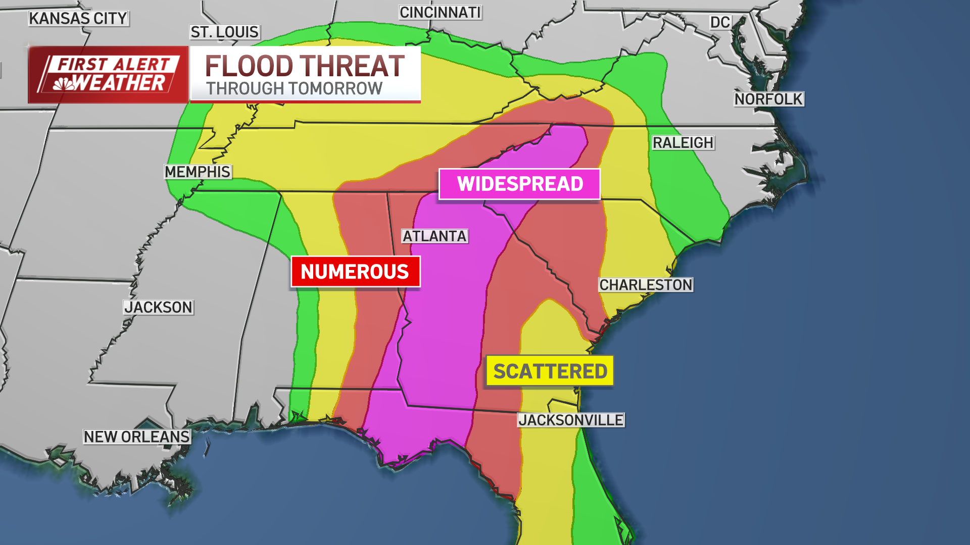
Helene is expected to weaken into a remnant area of low pressure into the weekend but will meander across the mid-South through at least Sunday. The storm is not forecast to impact New England.


