FIRST ALERT: Severe thunderstorm warning in western Mass., New England set for more
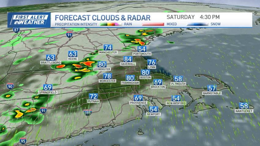
More severe thunderstorms will develop Saturday afternoon and will head towards Boston by the evening

More severe thunderstorms will develop Saturday afternoon and will head towards Boston by the evening

The weekend isn’t a washout, but we are dodging a few drops.

Jacob Henriques, an assistant admissions director at Emmanuel College in Boston, is facing a federal charge of attempted sex trafficking of a minor

Marconi Beach in Wellfleet, Massachusetts, has been closed since the stairs were wiped out during a nor’easter in September

Massachusetts State Police Col. Geoffrey Noble praised the IACP, which was selected to assess the academy’s curriculum and training methods, one of the changes following the death of Enrique Delgado-Garcia


Affordable housing advocacy groups say competition from college students can leave local residents priced out of their neighborhoods and unable to afford rising rent

Red Sox second baseman Kristian Campbell has been named the American League Rookie of the Month for March and April.

The teen volunteers from the Hyde Square Task Force found similar prices at Jackson Square compared to Dedham, Massachusetts, but prices are still higher elsewhere in Boston

A former Massachusetts State Police sergeant who was among six people charged in a scheme to take bribes in exchange for giving passing scores on commercial driving tests was found guilty in federal court Friday on most counts, prosecutors said.

The Celtics and Knicks are set for their first postseason series since 2013 and their 16th in NBA history. Here’s a look back at the history between the archrivals.
