


Temperatures are dipping into the 30s for many at night and frost is possible across New England. More in your First Alert forecast.
Follow NBC10 Boston:
https://instagram.com/nbc10boston
https://tiktok.com/@nbc10boston
https://facebook.com/NBC10Boston
https://twitter.com/NBC10Boston
We'll see improving conditions across southern New England this afternoon as a cold front moves off the New England coastline and drier air works in from the west. We’ll keep the threat for an isolated shower or sprinkle in the forecast through this evening, but overall, the afternoon will be mainly dry with some sunny breaks developing.

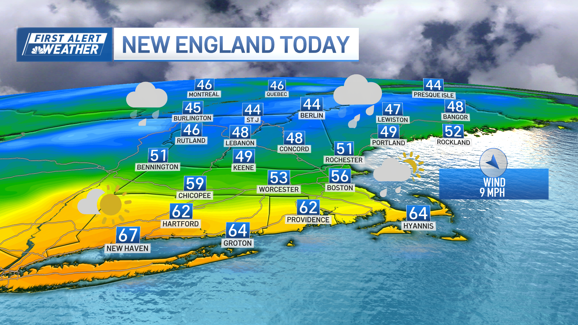
Northern New England will hold onto the rain showers through much of the afternoon with some wet snow mixing in through this evening across the higher elevations where we could see a light accumulation. Highs will range from the mid 50s to low 60s south, upper 40s to mid 50s north with a west wind on the increase through this evening.

Overnight tonight will be breezy and chilly with a mostly clear sky, except far northern New England where clouds will hold on, especially across the higher elevations where we’ll see a few snow showers. The west wind will be prevalent, gusting over 25 mph at times, diminishing a bit during the late-night hours.
Lows will be mostly in the 30s tonight, either side of 40 near the immediate coastline south, a few 20s possible across the interior, especially central and northern New England.

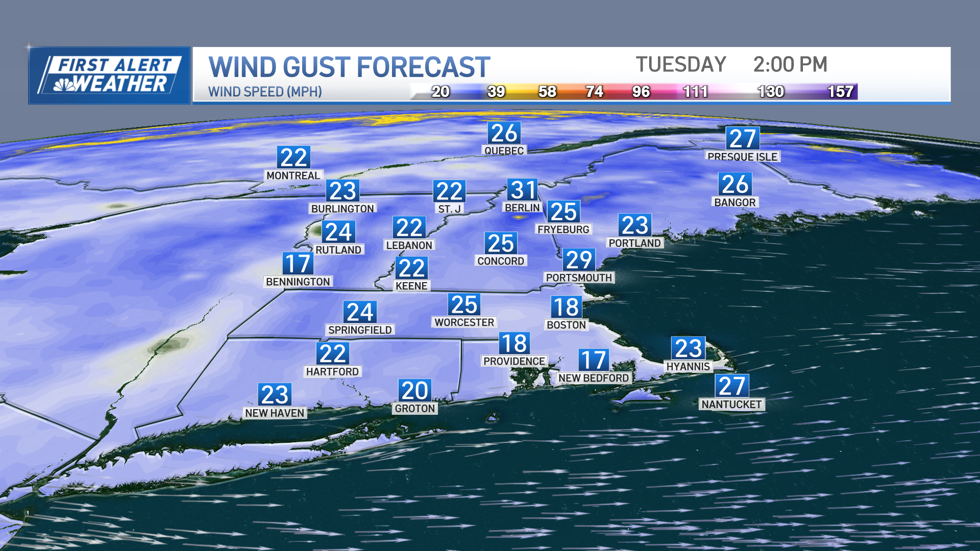
Sunshine returns Tuesday but we’ll remain on the cool and breezy side with a few clouds popping up during the afternoon. Most of the region stays dry, but snow and rain showers will continue across the highest elevations with light accumulations expected there. The west wind will keep its presence known with gusts over 20 mph throughout the day. Highs will range from the upper 40s to mid 50s south with the coolest temps across the higher elevations, upper 40s to low 50s in northern New England.

The rest of the work week will feature dry and cooler than average temperatures with some patchy frost possible as winds become lighter during the overnights. A warming trend is expected by the weekend with daytime highs reaching the 60s and 70s which is featured on our Exclusive 10-Day Forecast!


