


Saturday will be windy and partly cloudy. Watch the video to see what else to expect in the days ahead.
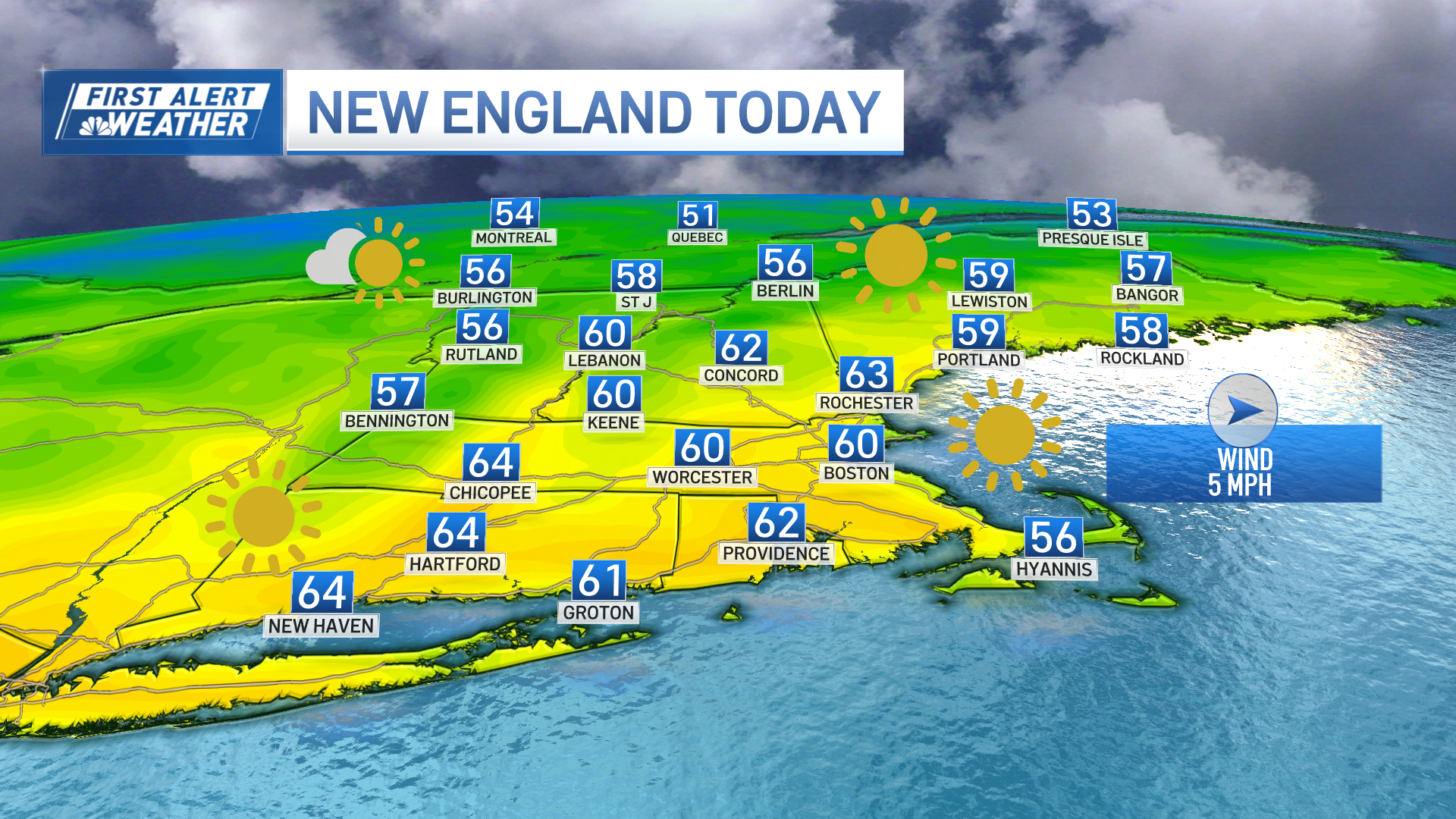
High pressure over New England will furnish us with plenty of sunshine and temperatures closer to average today as we close off the work week.
A light northwest wind will diminish a bit this afternoon allowing for wind to become onshore along the coast keeping temperatures down a bit there. Inland we’ll see temps climb a bit higher. Highs reach the low to mid 60s inland, around 60 immediate coast, 50s Cape and across the higher terrain of northern New England.

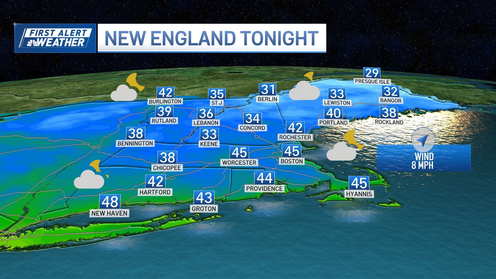
We'll see more in the way of clouds around tonight with the wind switching to the southwest. This will prevent temperatures from dropping too low across southern New England, but a few inland low lying areas may fall into the 30s. Overnight lows will be mostly in the low 40s south, 30s for central and northern New England.
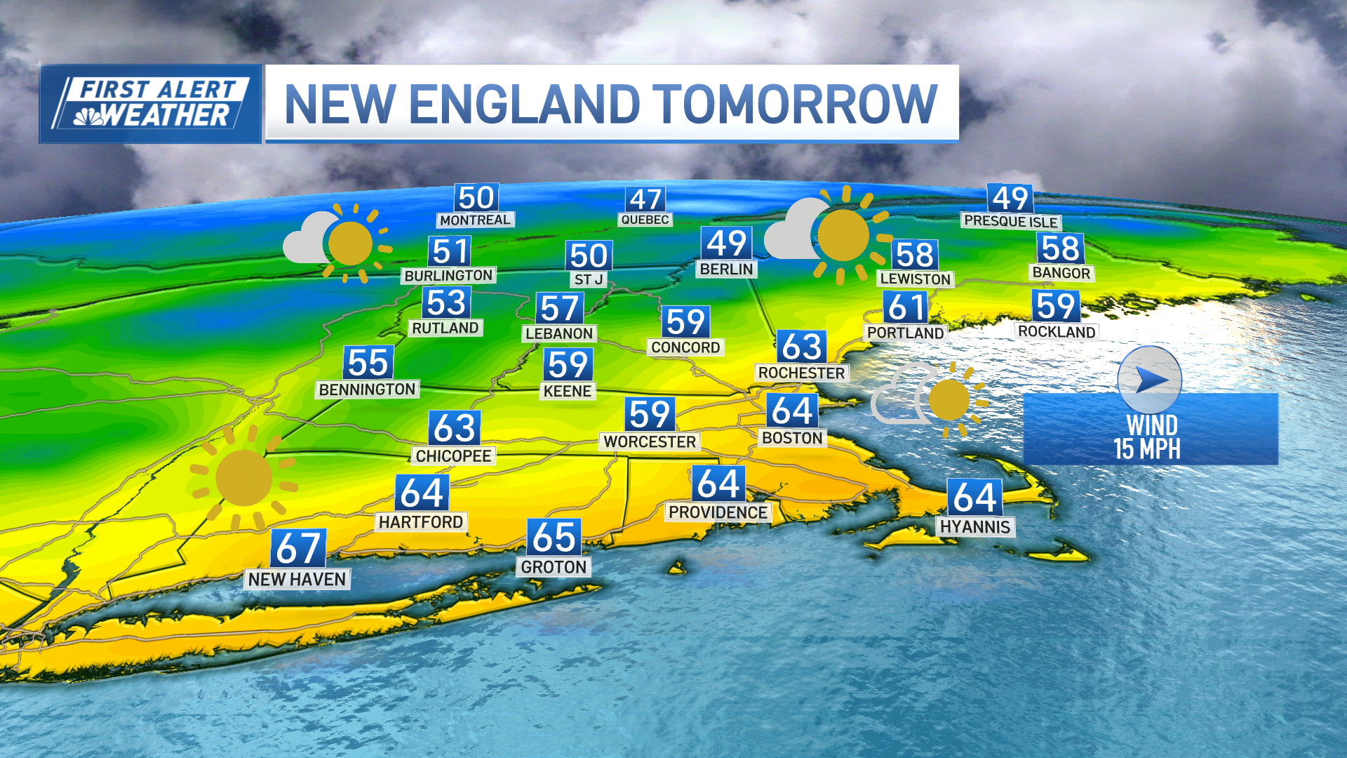
We start the weekend off on the mild and mostly sunny side again with a moisture-starved cold front passing through the region during the day. A west wind will pick up late in the morning and will gust up to 25 mph during the afternoon as the cold front slides through the region…expect a few more clouds around during the afternoon with a stray shower/sprinkle across the higher terrain, but most of the region will stay dry. Highs mid 60s south, upper 50s north.
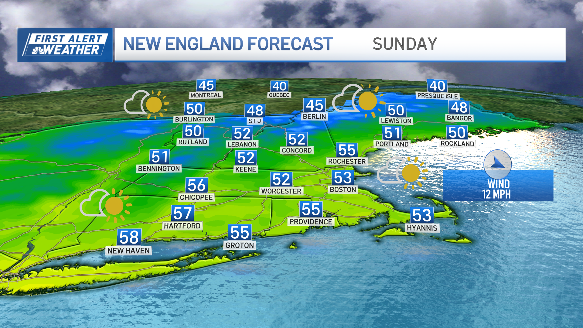
Big changes are on the way Sunday with cooler, more seasonable temperatures settling into the region. We’ll see a good amount of sunshine, except across the higher terrain where upsloping winds will bring some cloudiness along with rain/snow showers across the northern mountains.
Highs reach the low 50s south, upper 40s north. The cool conditions stick around into Monday with morning lows on Monday in the 30s, few 20s inland and north…afternoon highs in the 50s again with a good amount of sunshine. The chilly temps don’t last long as warmer conditions are expected to return during the mid-week with highs reaching the 70s by Halloween!
Get the latest forecast anytime here.


