
Severe thunderstorm warnings were in effect in parts of Massachusetts, New Hampshire, Vermont and Maine, but they have since expired. You can see the latest severe weather alerts here.
The heat is on! We are amid the hottest temperatures we’ve seen so far this year and summer officially hasn’t really started yet -- or has it?
Technically, the answer is yes for us in the science field and no for those who follow the stars. Meteorological summer started June 1 and continues through Aug. 31. Astronomical summer officially begins Thursday at 4:50 p.m. EDT and ends on Sept. 22.
Get New England news, weather forecasts and entertainment stories to your inbox. Sign up for NECN newsletters.
For those that may be confused, meteorological summer represents the warmest months of the year -- June, July, and August -- whereas astronomical summer is representative of the sun’s most direct rays which reach their northernmost latitude, the Tropic of Cancer on Thursday during the summer solstice... It is also the day we see our most daylight of the year: 15 hours, 17 minutes, and 14 seconds in Boston!

A Heat Advisory is in effect for much of the area through Thursday evening, with the exception of south coastal New England, Downeast Maine, and the Cape and Islands, where temps will be in the 70s and 80s…the rest will see afternoon temperatures soaring into the mid to upper 90s with heat indices just over 100 degrees. Portions of interior southern New Hampshire into interior Maine are under an Excessive Heat Warning through this evening due to the extreme heat and humidity bringing heat indices close to 105 degrees!

Most of the region will be on the dry side Wednesday afternoon, but a few showers and thunderstorms develop, especially across Vermont, New Hampshire, and Maine. A couple of those may drop into northern Massachusetts on Wednesday evening as well. Some of those may be strong to isolated severe.
Thursday will be the last day of the extreme heat, with temperatures topping out in the mid to upper 90s again, along with high humidity. Expect more scattered showers and thunderstorms to develop across northern New England during the afternoon before diving into northern Massachusetts by the late afternoon. Some of these may be strong to severe.

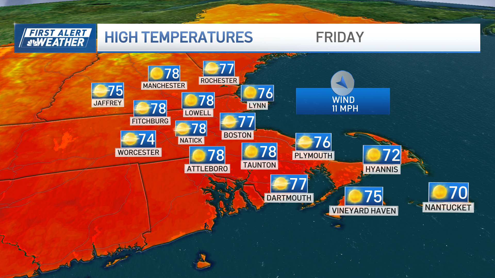
Big changes arrive Friday as our wind directions turns more out of the northeast as a backdoor cold front arrives. We’ll stay on the humid side, with temperatures topping off in the low to mid 80s, dropping into the 70s by the afternoon along the coast with a stiff northeast wind. As of now, the Celtics championship parade looks mostly on the dry side, with scattered showers and storms holding off until later in the afternoon. At least the heat will be gone!
Weather Stories

As we peek into the weekend, temps will stay on the warm side in the 80s with the threat for afternoon showers and storms.
