Today (Sunday): Mostly sunny, hot, bit less humid, sea-breeze coast. Highs upper 80s to low 90s.
Overnight Tonight: Few clouds, muggy. Lows low to mid 70s.
Monday: Mosty sunny, hot, & humid, isolated PM storm. Highs low to mid 90s, heat index upper 90s to 100.
Tuesday: Extremely hot & humid, isolated PM storm. Highs mid 90s, heat index 100+.
After a small, a practically negligible reprieve, the blazing heat is back.
Monday will feature spots of fog, but plenty of humidity through mid-morning and afternoon high temperatures in the mid-90s. The chances of rain are quite small, too, and driven by the heat of the evening.
A First Alert has been issued from Monday through Wednesday due to the dangerous conditions.

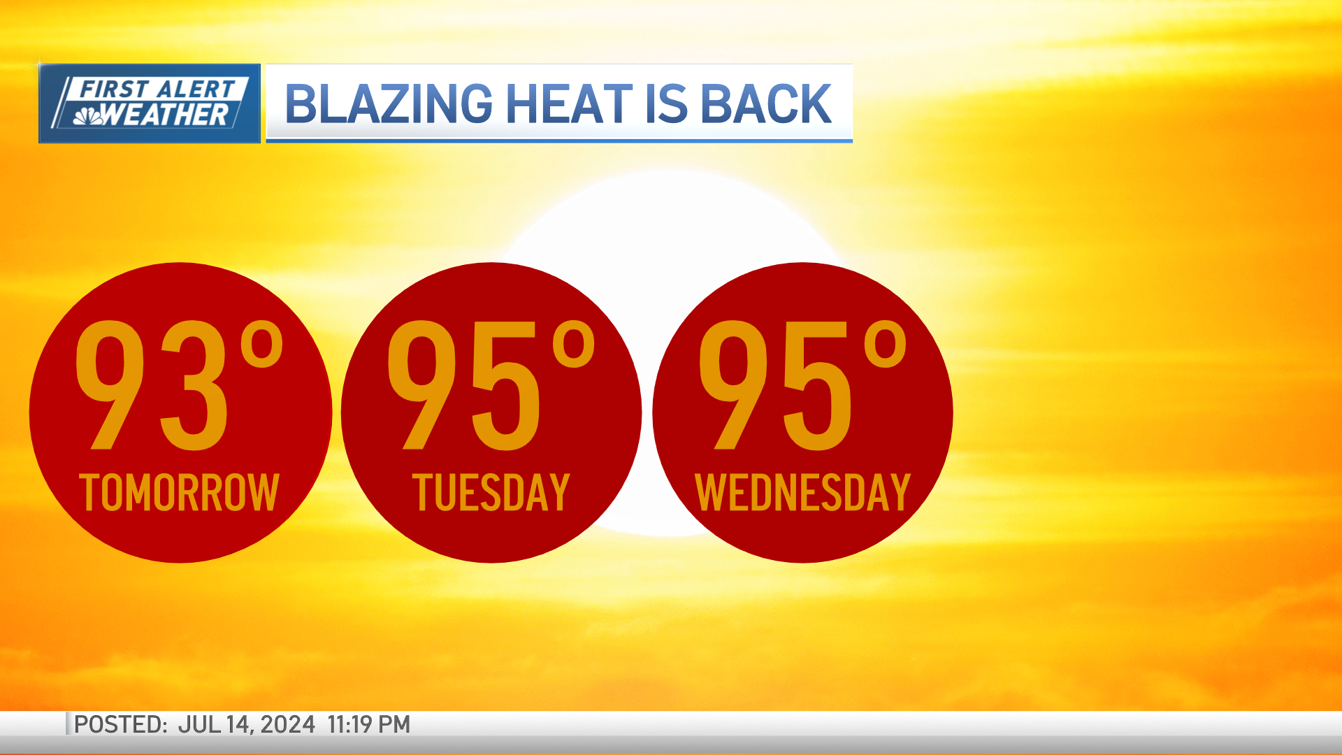
Any downpour would be quick and fast moving. The heat risk continues Tuesday and Wednesday with highs near 95 degrees, afternoon heat indices are closer to 100 degrees by Wednesday with again, a quick downpour but most of the rain will arrive Wednesday evening and Thursday morning.
This is a much larger system with fire power to bring cooler air. This isn't a far reach to say the air will be more refreshing and lows dip into the 60s, and dewpoints drop to the low 50s by the weekend.
We go from soupy air to savory by the end of the week!