We had some record low temperatures Friday morning as lows dropped to the low 40s across the far North Country.
Most suburbs started in the 50s with dewpoints in the 30s to 40s. The extremely dry airmass means that we have minimal cloud development today, perhaps some high level and thin cirrus clouds later on. Highs reach the mid to upper 70s with some afternoon sea breezes at the shore.
Highs on Saturday stay in the mid to upper 70s with a wind direction shift. As the south wind transports in more moisture, our humidity rises during the day and more clouds develop.

Get New England news, weather forecasts and entertainment stories to your inbox. Sign up for NECN newsletters.
Northwestern New England also will see scattered showers and thunderstorms develop by afternoon through evening. Some of the thundershowers make their way towards southeastern New England overnight into Sunday morning.
This is just the precursor to more storms later Sunday.
Humidity returns by Sunday as temps increase to the mid and upper 80s. Dewpoints in the low 70s will support some heavy rainfall with anything that moves through.

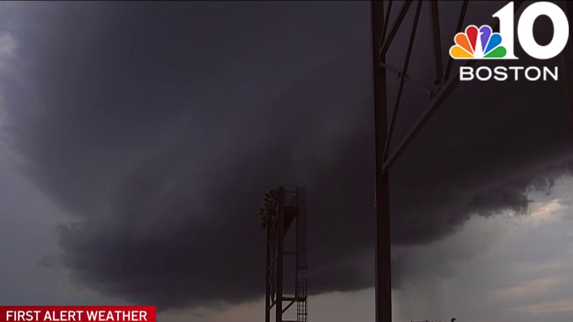
A cold front approach and will bring in a round of storms and showers by the afternoon through evening, especially noon to 8 p.m. If the timing coincides with peak daytime heating hours, we may again see a round of severe storms. Stay tuned on this since the timing can still change.
The Storm Prediction Center has already highlighted most of eastern New England for scattered severe storms on Sunday with damaging wind and hail. Lightning and localized flooding will also be threats.
After Sunday, high pressure returns and keeps away any rain through Wednesday next week for any July 3rd cookouts and celebrations.

Temps go from the mid-70s Monday, to the low 80s by Wednesday. Independence Day has a chance for rain or storms late in the day, but for now it does not look like a washout with highs in the mid-80s.