
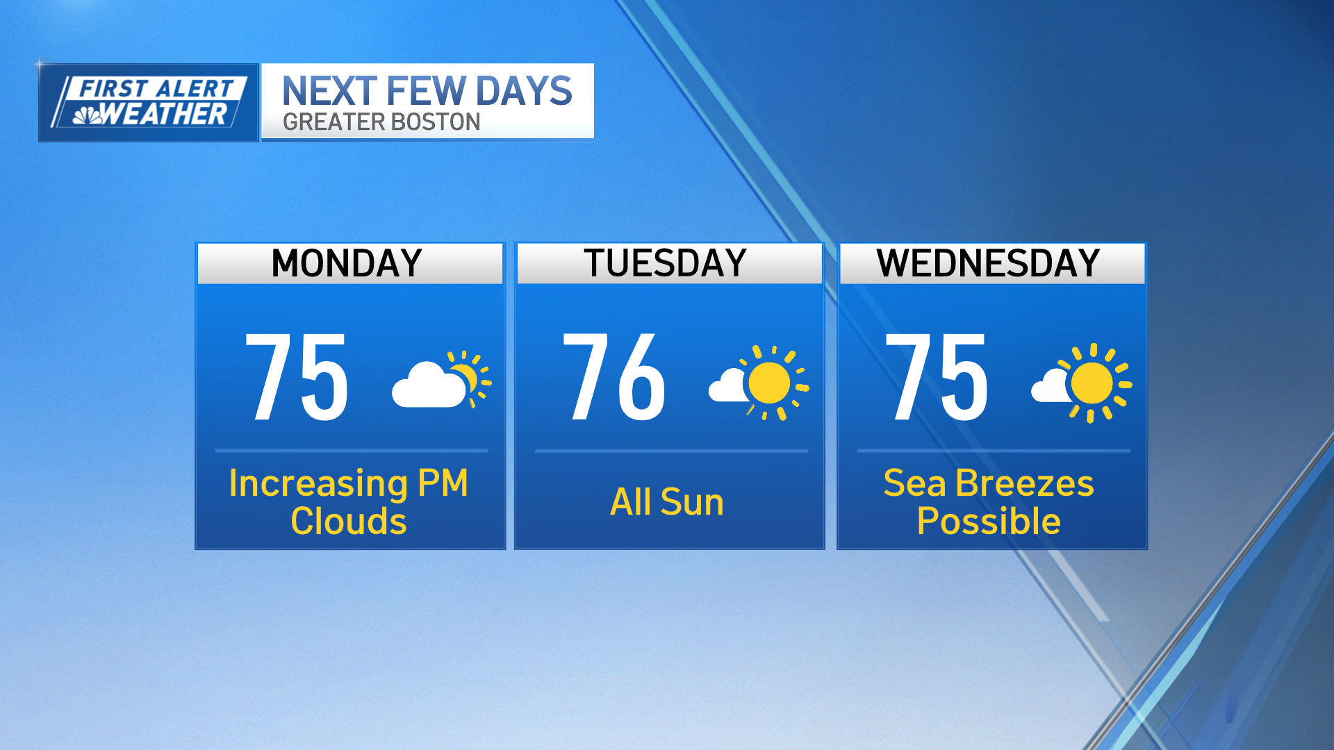
After another drab weekend, it's time for the pattern to shift — again. This time, however, the warmth will last more than a day. And the summery levels we reach will be pretty eye-popping for this early in the season.
We're still shaking the clouds Monday, along with some patchy early morning fog. Onshore breezes will keep the coast near 60, while we commence the warmup with 70s elsewhere. Tuesday is the day we soar through the 80s and attempt to make a run for 90 in spots.
The southwest wind will help in that respect. It's a wind direction that has been pretty rare in recent months.

Wednesday is the hottest of the stretch. Nineties will be quite common, and it's even possible Boston touches the magic mark in the afternoon. There won't be a lot of humidity, but it will be noticeable.
Dewpoints rise to the low 60s, giving it a true summer feel outside, and making it worthy of a day at the beach or dining/grilling outdoors. Thursday is still warm, but there will be more clouds with a few scattered showers sprouting in the afternoon as the cool front moves through.
"But what about the holiday weekend?" We're certain it's not as warm, but we're thinking much of it will remain dry.

The only threat for showers would be on Memorial Day as a weak weather system moves in our direction. Lots to play out in the coming days (in terms of how much cooler it will be and general timing for any wet weather), so check back often.
Weather Stories

Have a great week!
