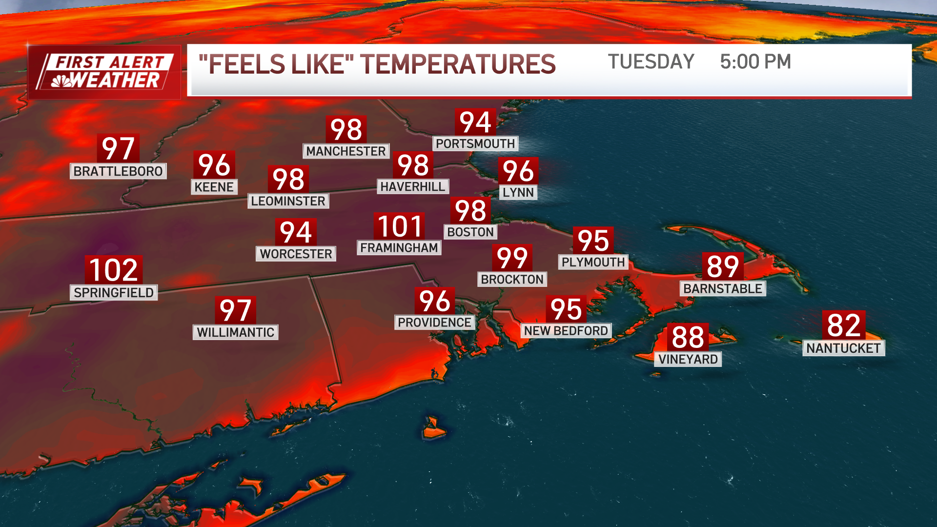
Monday night: Partly cloudy, patchy fog. Lows in the 70s. Tuesday: Hot, humid, sunny, afternoon storms. Highs in the mid 90s, heat index around 102. Wednesday: Sunny to start, late thunderstorms, hot and humid again. Highs in the mid 90s, heat index around 101.
A hot start to the week with temperatures in the low 90s with noticeable sticky humidity the next three days.
Severe thunderstorms have been moving through New England. See a full list of severe weather alerts here.
This heat and humidity will have heat indices feeling above 100 degrees at times. This dangerous heat prompts a heat advisory ahead of the triple-digit feels-like temperatures.

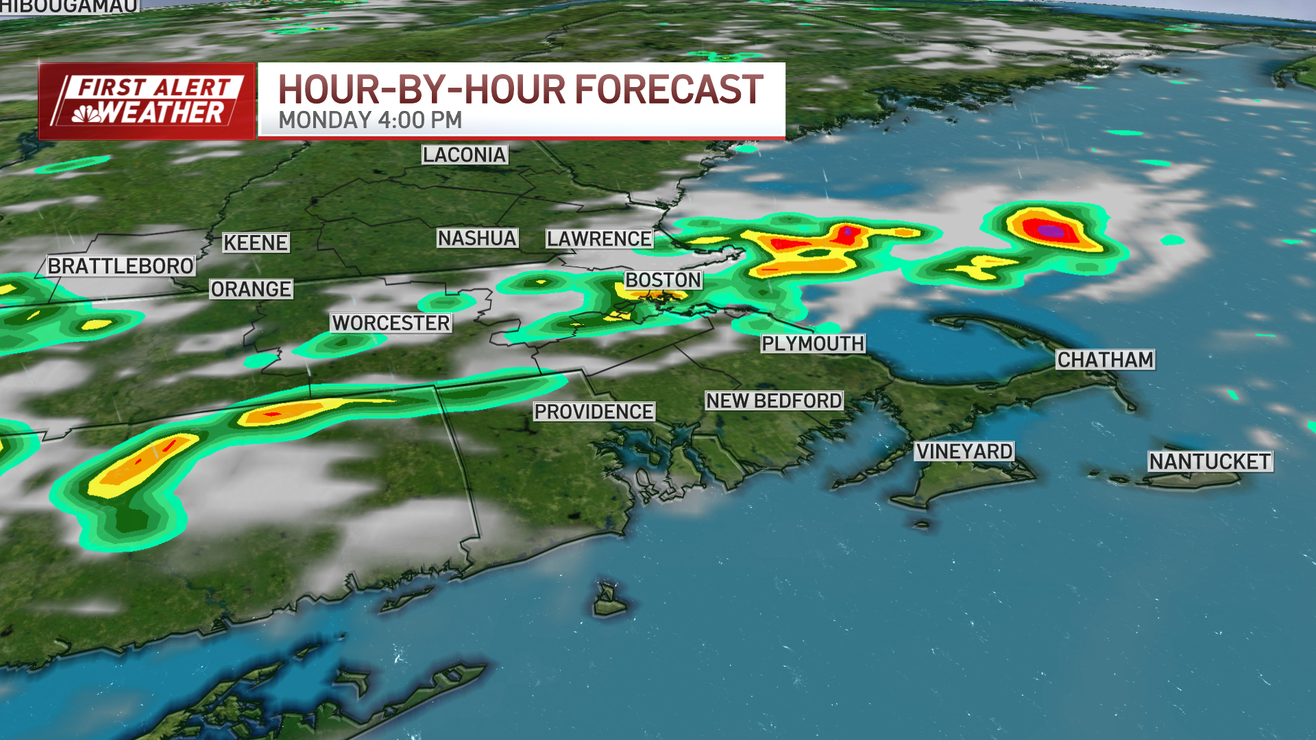
Strong to severe storms each day through Thursday. This afternoon will be our first storm chance between 4 p.m. and 8 p.m.
Another round of rain early Tuesday but beginning around 1 a.m., you could hear some rumbles of thunder. Tuesday around 8 p.m., storm chances kick back up for round two.
A pattern change will be clear by Thursday afternoon with less humid air and more comfortable and dry conditions through the weekend.