
Young boy stepping on needle in Boston park prompts calls for change
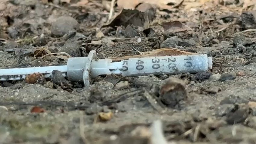
The incident at South Boston’s Moakley Park, not far from Mass. and Cass, is leading Massachusetts lawmakers to search for solutions.
The incident at South Boston’s Moakley Park, not far from Mass. and Cass, is leading Massachusetts lawmakers to search for solutions.

The Red Sox are “no longer entertaining the idea” of trading All-Star outfielder Jarren Duran ahead of the deadline, according to WEEI’s Rob Bradford.

Rookie offensive tackle Will Campbell had a “welcome to the NFL” moment in the Patriots’ first full-pads practice Monday, writes Phil Perry.

Tom E. Curran breaks down what he saw from the Patriots’ wide receivers during Monday’s training camp practice.

Prosecutors allege that Michael Bragel almost smashed into another car and then fired a gun toward the other vehicle during an incident on I-93 earlier this month.


Mass General Brigham layoffs cost $53 million

A federal judge on Monday ruled Planned Parenthood clinics nationwide must continue to be reimbursed for Medicaid funding as the nation’s largest abortion provider fights Trump’s administration over efforts to defund the organization in his signature tax legislation.

The woman, identified as 40-year-old Rosane Ferreira De Oliveira, was charged in February with assault and battery with a dangerous weapon on a pregnant victim, according to records from the Worcester District Court.

A missing 19-year-old with intellectual disabilities was found safe in Norton, Massachusetts, on Monday.


Two people, including a child, were taken to the hospital after being bitten by two loose dogs near Flax Pond Park in Lynn, Massachusetts, over the weekend.


