Most of New England managed a pretty nice weekend, perhaps one of the nicest of the summer.
But it was not the same for all. Another round of very heavy rain moved into Vermont late yesterday and then spread across New Hampshire into western Maine last night. The result was more flash flooding in areas that have been so hard hit with the record July rains.
There are two weather systems impacting New England, a weak low pressure system crossing far Northern New England, and another low pressure system south of New England. They each gradually loosen their grip today.

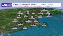
After a few more downpours and maybe a bit more thunder this morning, we’re going to turn into a mix of sun and clouds this afternoon with just some scattered showers. By dinner time we should be mostly dry, high temperature in the 70s to low 80s.
Wind is fairly light, tending to come around from the Northwest.
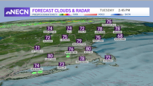
Weak high-pressure should give us a nice night tonight, with a fair sky and low temperature in the 50s and 60s, followed by a nice looking Tuesday. Plenty of sunshine tomorrow, though high thin clouds may return south, high temperature in the 70s, with comfortable humidity.

The plot thickens Wednesday, there will be a front coming in from Canada in Northern New England with a chance of showers. There will also be a series of very wet waves of low pressure rippling just south of Nantucket Island.
Weather Stories
It’s possible that southeastern Massachusetts could get quite wet Wednesday and Thursday, with just scattered showers and thunderstorms elsewhere. Temperatures are probably holding in the 70s.
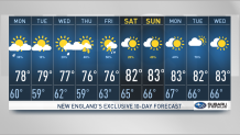
The coastal systems should ease far enough out to sea for some nice weather later Thursday and Friday, but additional energy from Canada may generate sunshine and thunderstorms in the afternoon with high temperature again in the 70s to near 80°.
The early call for the weekend is for warmer weather, with a chance of afternoon showers or a thunderstorm, but not a washout. Stay tuned to our First Alert 10-day forecast for the latest.


