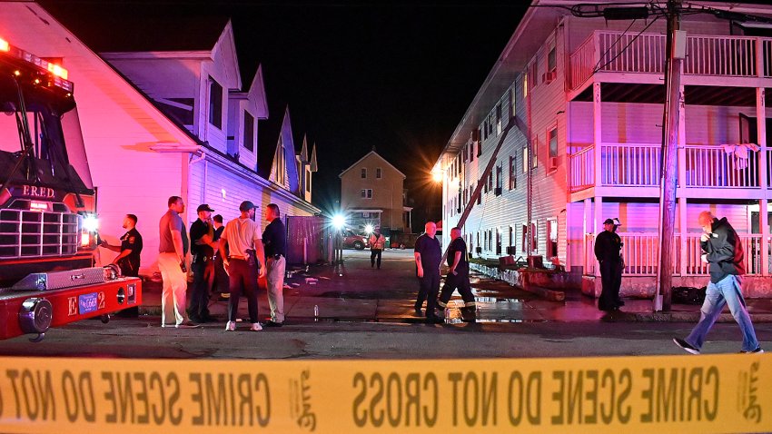
forecast

Overcast conditions continue on Sunday night in New England

Closer to the coast, clouds will hold on a bit tighter, but we will see some glimpses of sun along with a north to northeast wind. 

NBC Universal, Inc.

Low pressure pulls away from New England this afternoon, but clouds will be a bit stubborn to exit behind it.  Overall, this afternoon will shape up to be a pretty decent across the interior of southern and central New England with highs reaching the upper 50s to low 60s thanks to some sunny breaks and a light breeze out of the north. 

Closer to the coast, clouds will hold on a bit tighter, but we will see some glimpses of sun along with a north to northeast wind.  Wind direction makes all the difference this time of year, a subtle onshore shift can make the difference between temperatures staying in the 40s this afternoon versus reaching the mid 50s. 

For now, we’re forecasting highs around Boston to reach the low 50s, a bit milder the further away from the coast, cooler across the Cape with highs in the 40s.

Overnight we’ll see increasing clouds and a northeasterly air flow developing which will keep us on the cooler side Monday.  Fog and drizzle will also creep in overnight and stick around through the early morning hours.  Lows tonight drop into the upper to low 40s south, 30s north.  Highs Monday in the 40s, few 50s inland.

The upcoming week will be on the unsettled side with several rain chances.  The first of which arrives in the form of rain showers late Monday night and continues throughout the day Tuesday.  A bit of a lull in the action Wednesday morning/early afternoon along with temperatures well into the 50s, before the next batch of rain arrives later in the day and continues into Thursday. 

That system may end as snow across the higher terrain late Thursday into Thursday night as cooler, more seasonable air rushes back in via a gusty northwest wind.  Still some wiggle room in that portion of the forecast.  Next weekend looks unsettled once again with more precipitation moving in at some point Saturday, but with so many moving parts in the forecast, that may likely change…stay tuned!

Have a great Sunday!

Contact Us