


A phenomenal afternoon is setting up with plenty of sunshine and warm temperatures as high pressure anchored over the eastern seaboard sets us up for a beautiful stretch of Autumn weather which will last right through the middle of next week!
A phenomenal afternoon is setting up with plenty of sunshine and warm temperatures as high pressure anchored over the eastern seaboard sets us up for a beautiful stretch of autumn weather which will last right through the middle of next week!
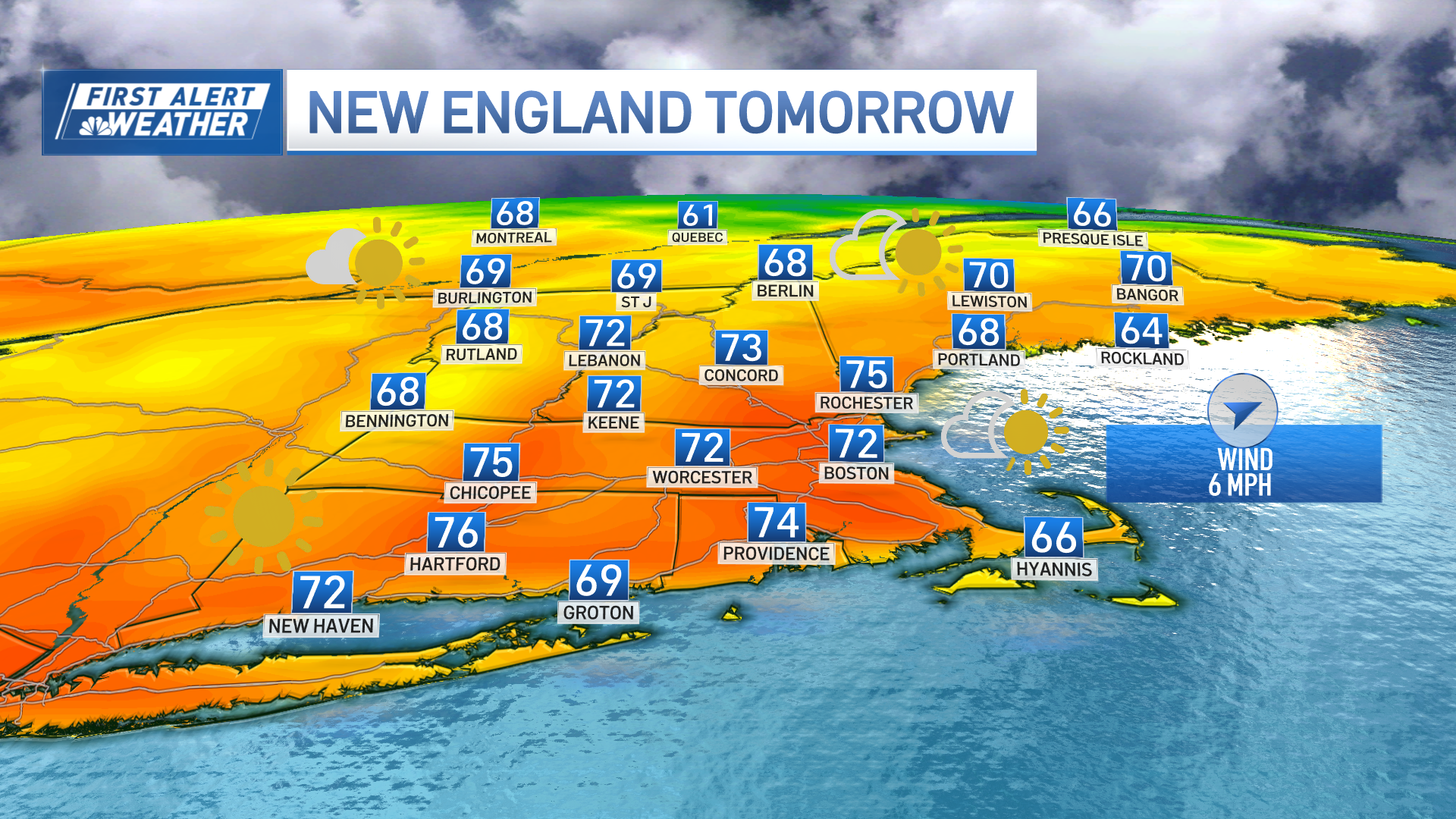
There's plenty of sunshine to be had this afternoon from Maine to Cape Cod along with warm temperatures and a light westerly breeze, locally onshore at the immediate coast.


An early afternoon high tide which is still astronomically high may produce some minor coastal flooding in the usual prone low-lying coastal communities, but overall, not expecting anything widespread. Highs reach the low to mid 70s inland, upper 60s coast, bit cooler across the Cape and Islands.
A clear sky, light wind, and dry air featuring low dewpoints will allow for some radiational cooling across the low-lying areas and valleys of the region allowing for temperatures to cool off into the 30s, few upper 20s once again well inland, the rest will see temps mainly in the 40s.

The west wind will be a bit more prevalent Sunday allowing for much of the region to see temperatures reach the low to mid 70s. A weak system tracking north of New England may introduce a few high, thin clouds during the afternoon but overall, we’ll see plenty of sunshine much of the day with perhaps some dim sunshine at times.
Monday looks to be the warmest day of our beautiful stretch with lots of sunshine and temperatures soaring into the mid to upper 70s, with a few 80s possible across the lower Connecticut River Valley and Merrimack Valley!
If you’re wondering what the record high in Boston is for that day, its 82 degrees set back over a hundred years ago in 1920! It doesn’t look like we’ll see that happen again, but we’ll be in the neighborhood!
We’ll remain warm and dry right through the middle of the week with lots of sunshine. It’s not until Wednesday night when big changes arrive with a strong cold front passing through the area ushering cooler, more seasonable temperatures behind it, we’ll even see some much-needed rain showers to go along with it, but right now it doesn’t look to be enough to break the bank!

Either way, any amount of shower activity is welcomed news since much of the area north of Boston is currently experiencing a moderate drought with unseasonably dry conditions occurring across much of southern New England.
Weather Stories


Enjoy your Saturday!


